The following maps were produced by the U.S. Central Intelligence Agency, unless otherwise indicated.
- Antarctic Region (Political) 2005 (1.3MB) [pdf format]
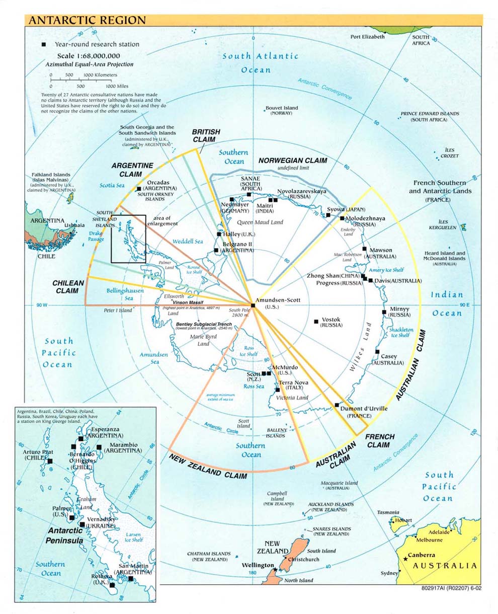
- Antarctic Region (Political) 2002 (206K) [jpeg format]
- Antarctic Region (Political) 2002 (207K) [pdf format]
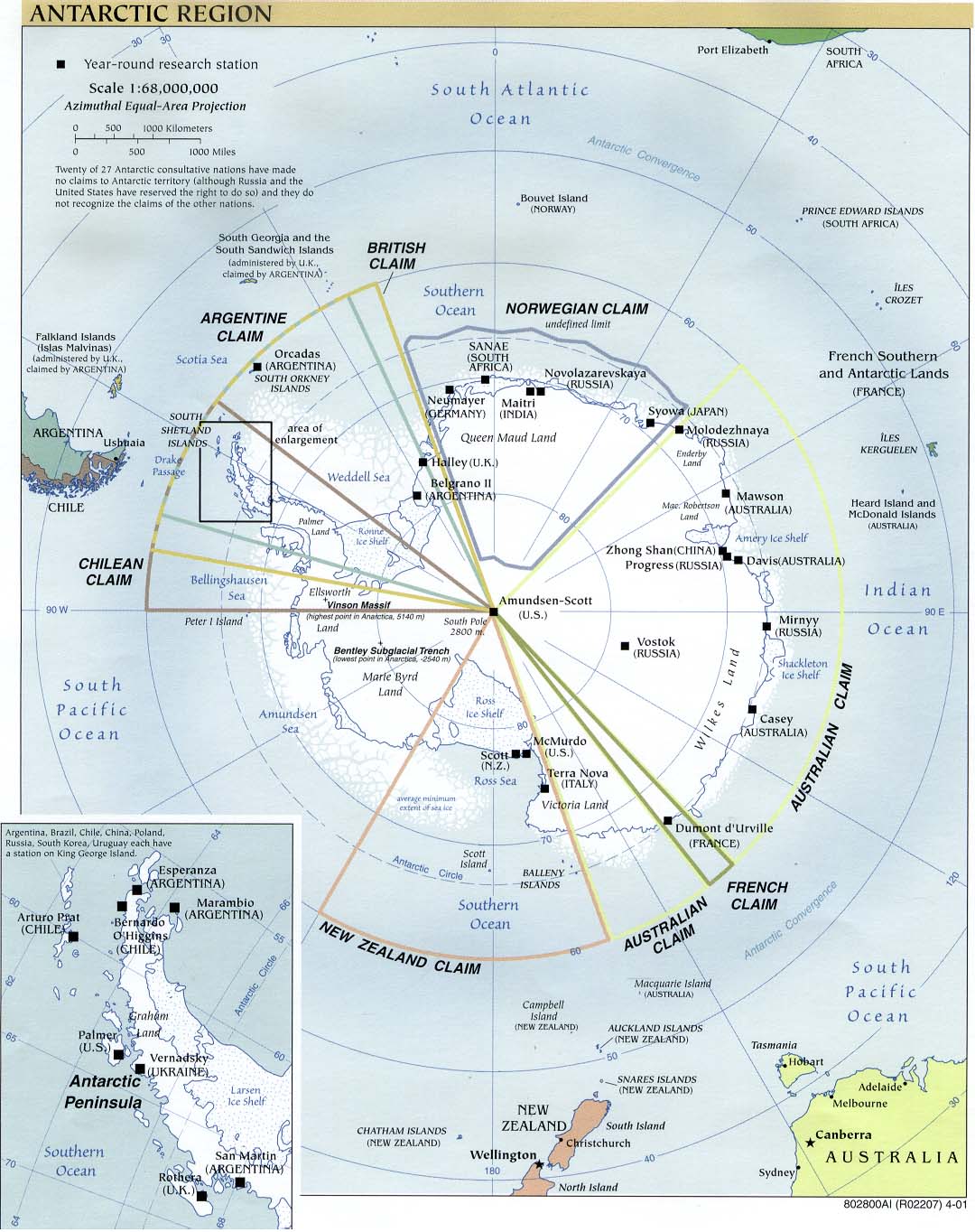
- Antarctic Region (Political) 2001 (223K) [jpeg format]
- Antarctic Region (Political) 2001 (1.1MB) [pdf format]
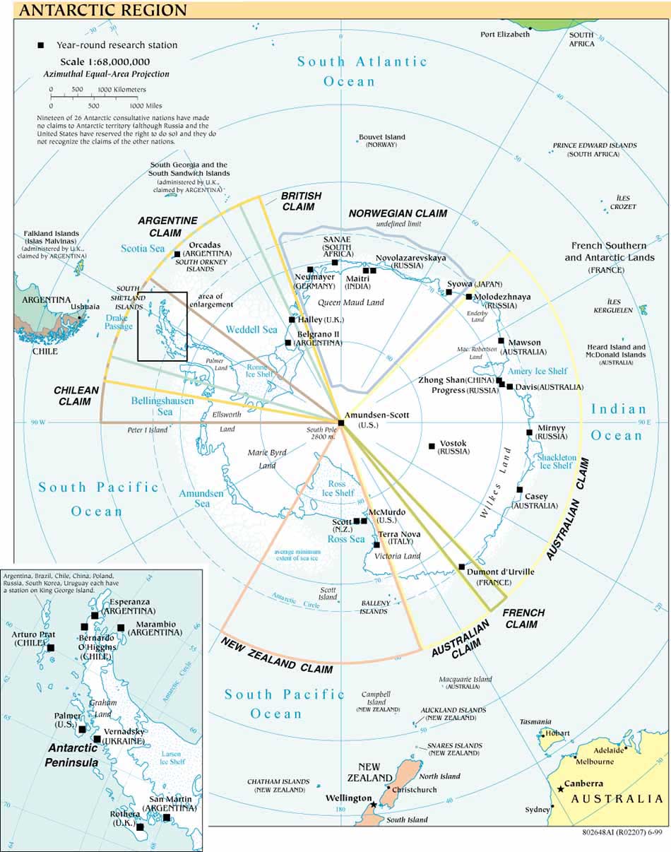
- Antarctic Region (Political) 2000 (280K) [jpeg format]
- Antarctic Region (Political) 2000 (769K) [pdf format]
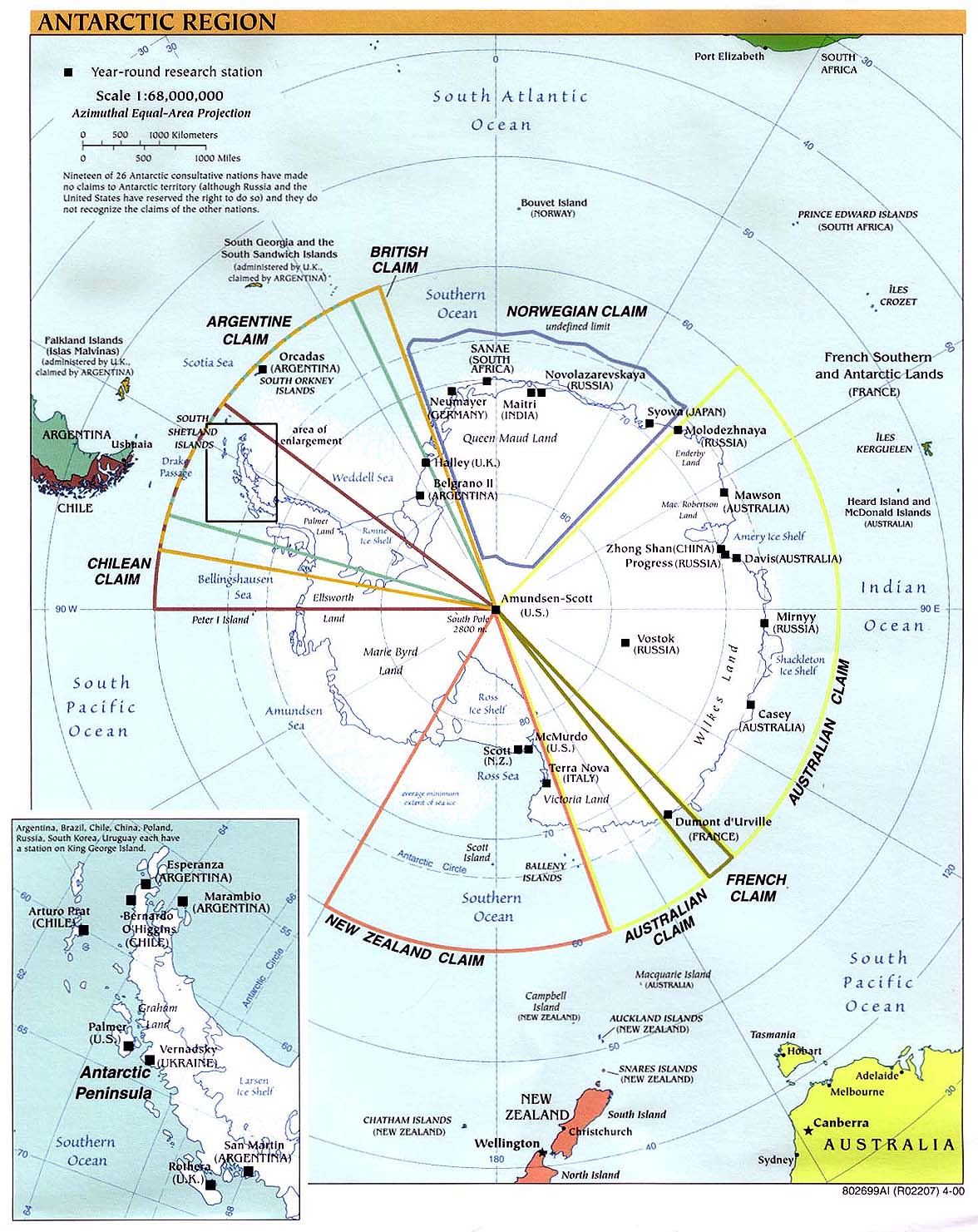
- Antarctic Region (Political) 1999 (162K) [jpeg format]
- Antarctic Region (Political) 1999 (162K) [pdf format]
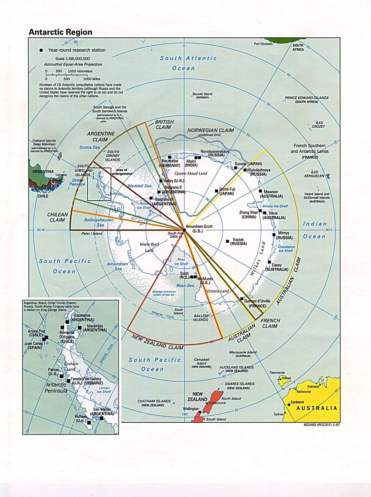
- Antarctic Region (Political) 1998 (387K) [jpeg format]
- Antarctic Region (Political) 1998 (332K) [pdf format]
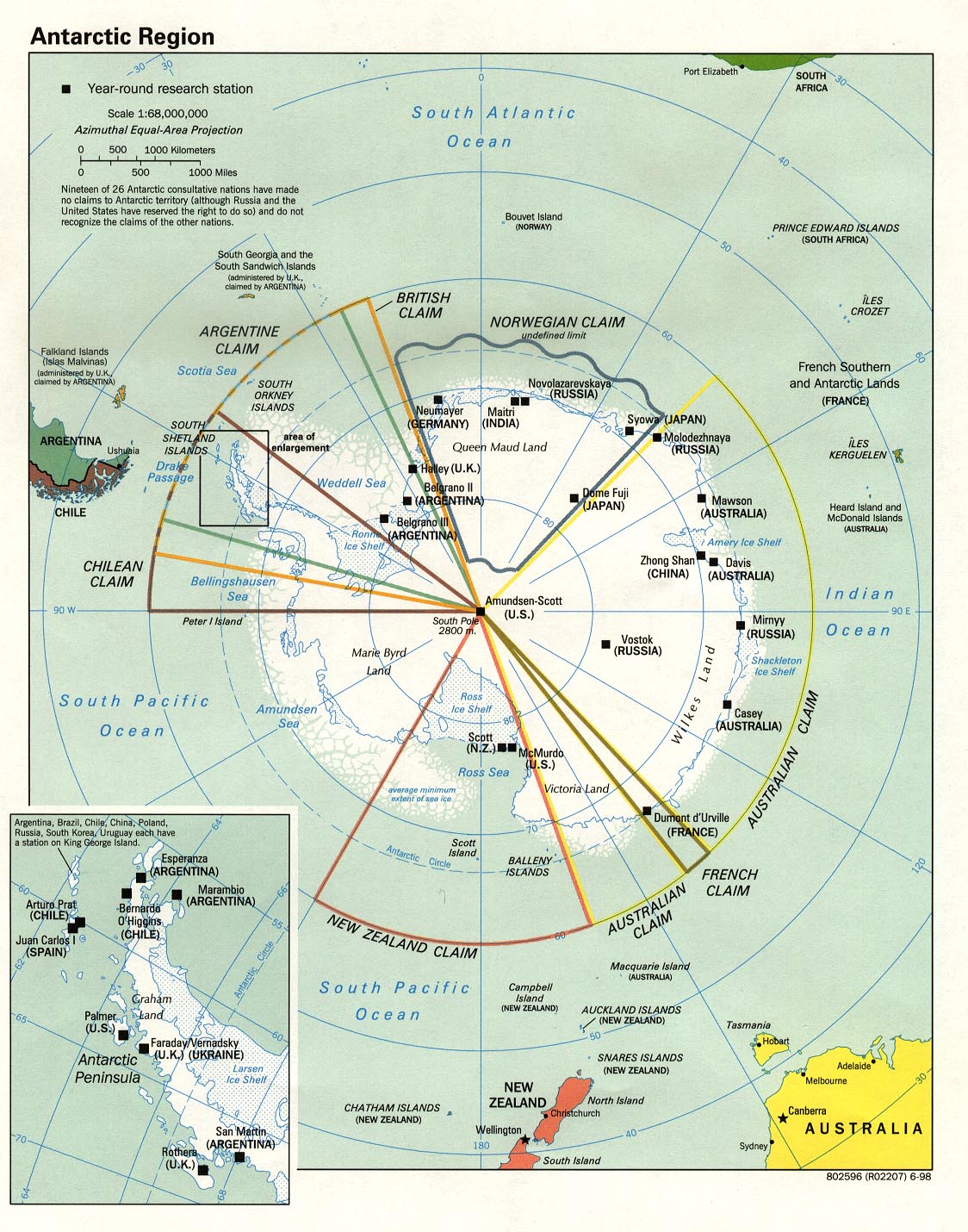
- Antarctic Region (Political) 1997 (374K) [jpeg format]
- Antarctic Region (Political) 1997 (1MB) [pdf format]
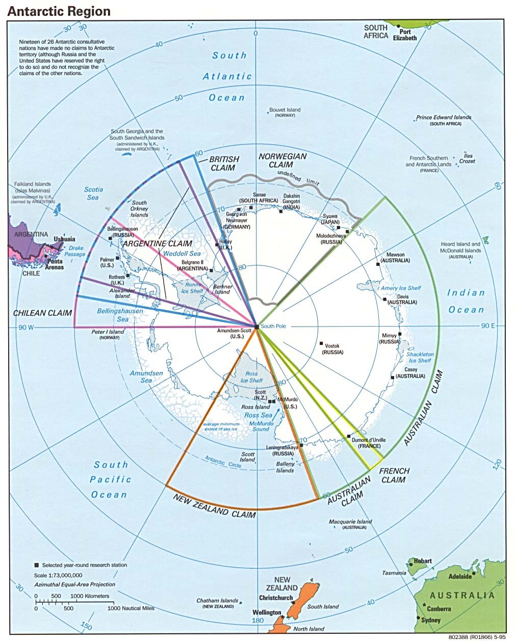
- Antarctic Region (Political) 1995 (213K) [jpeg format]
- Antarctic Region (Political) 1995 (216K) [pdf format]
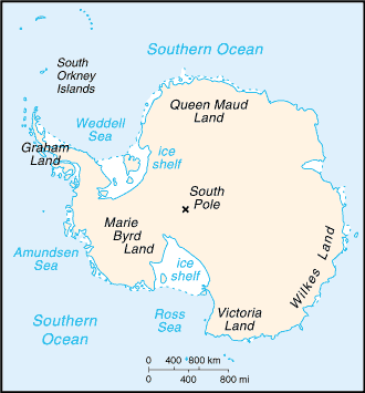
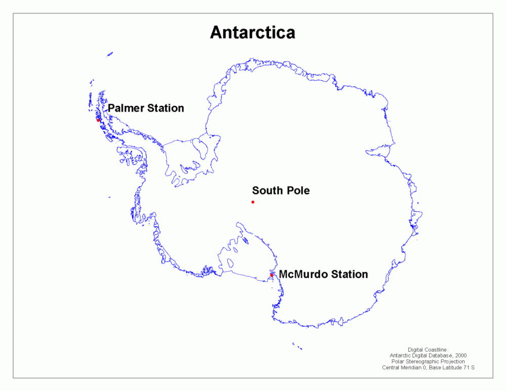
- Antarctica (Small Map) 2008 (10K)
- Antarctica - Research Stations and Territorial Claims (Shaded Relief) 1986 (387K) and pdf format (407K)
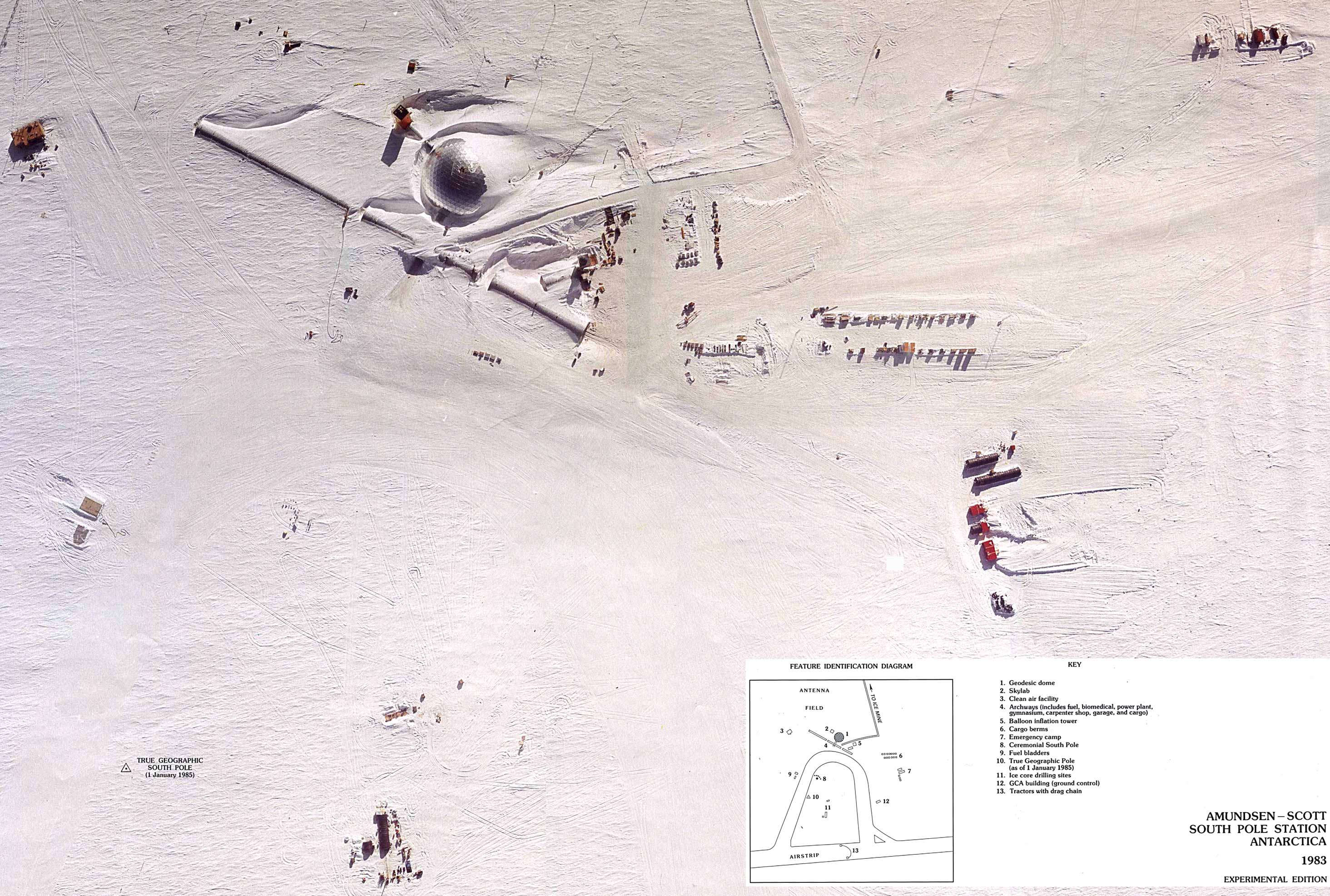
- Antarctica - South Pole Aerial View from Amundsen-Scott South Pole Station, Antarctica Photomap original scale approx. 1:1250 U.S.G.S. 1983 (758K)
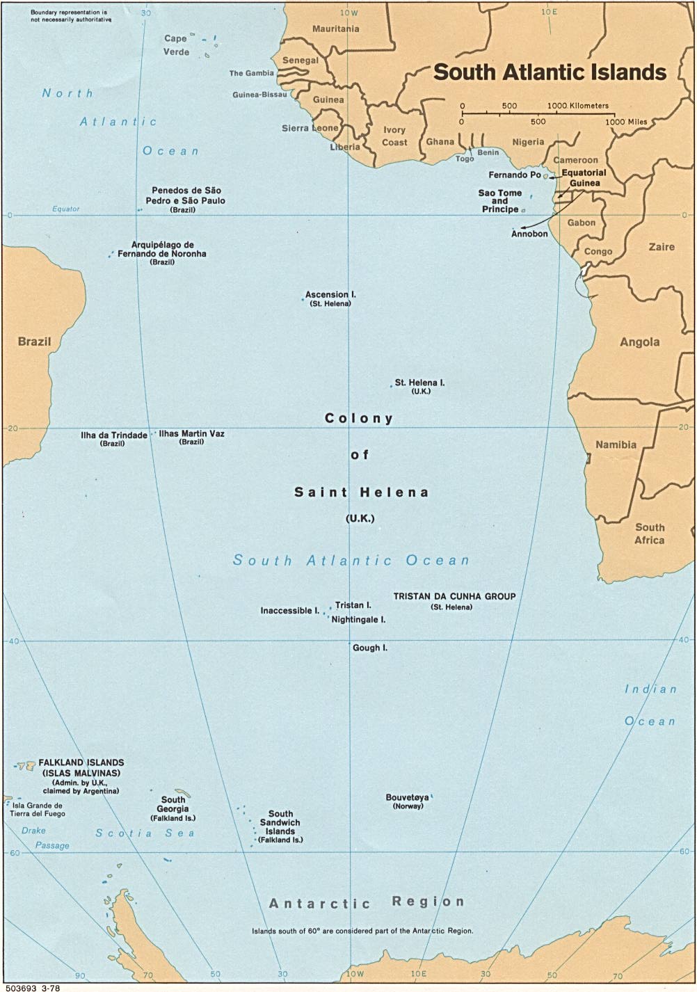
- South Atlantic Ocean Islands (Political) 1978 (172K)
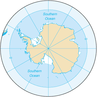
- Southern Ocean (Small Map) 2008 (10K)
http://www.lib.utexas.edu/maps/islands_oceans_poles/antarctica_research_station.gif
 Useful Maps & Images
US/Antarctic Overlay Map (GIF 59 KB)
US Permanent Stations in Antarctica (GIF 47 KB)
RADARSAT-1 Image of Antarctica (GIF 268 KB)
RADARSAT-1 Image of US Permanent Stations in Antarctica (GIF 318 KB)
RADARSAT-1 Image of Ross Island (GIF 391 KB)
RADARSAT-1 Image of Anvers Island (GIF 337 KB)
USGS Map of Ross Island (GIF 331 KB)
Palmer Station Safe Boating Map (GIF 77 KB)
RPSC and ASA Place Names Map (GIF 389 KB)
US Permanent Stations in Antarctica (GIF 47 KB)
http://www.usap.gov/USAPgov/sciencesupport/GIS/images/AntarcticPermStations.gif
US/Antarctic Overlay Map (GIF 59 KB)
http://www.usap.gov/scienceSupport/GIS/contentHandler.cfm?id=209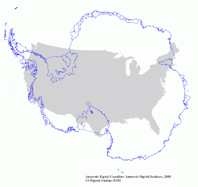
http://www.usap.gov/scienceSupport/GIS/contentHandler.cfm?id=209