Saturday, July 9, 2011

Magnetosphere Update - Saturday, July 8, 2011

http://www2.nict.go.jp/y/y223/simulation/realtime/index.html

CAVE NEWS YOU TUBE CHANNEL
DAILY SINCE DECEMBER, 2009


http://www.youtube.com/user/CaveNews?feature=mhum


ALASKA'S HAARP FLUXGATE MAGNETOMETER
http://137.229.36.30/cgi-bin/magnetometer/gak-mag.cgi


EARTHQUAKE UPDATE


Latest Earthquakes Magnitude 2.5 or Greater in the United States and Adjacent Areas and Magnitude 4.5 or Greater in the Rest of the World - Last

Update time = Sun Jul 10 0:02:32 UTC 2011

MAG UTC DATE-TIME
y/m/d h:m:s
DEPTH
km
Region
MAP 4.9 2011/07/09 23:47:30 10.0 ASCENSION ISLAND REGION
MAP 3.0 2011/07/09 23:22:14 3.0 ISLAND OF HAWAII, HAWAII
MAP 4.9 2011/07/09 23:17:59 10.0 ASCENSION ISLAND REGION
MAP 2.6 2011/07/09 23:15:10 20.0 SOUTHERN ALASKA
MAP 4.6 2011/07/09 22:44:45 137.1 MINDANAO, PHILIPPINES
MAP 5.0 2011/07/09 22:21:05 20.1 KERMADEC ISLANDS, NEW ZEALAND
MAP 2.9 2011/07/09 21:26:11 10.7 CENTRAL CALIFORNIA
MAP 4.7 2011/07/09 20:05:46 443.0 SOUTH OF THE FIJI ISLANDS
MAP 2.6 2011/07/09 19:44:38 5.0 CENTRAL CALIFORNIA
MAP 5.7 2011/07/09 19:35:20 21.7 KERMADEC ISLANDS REGION
MAP 5.1 2011/07/09 19:34:36 5.4 KERMADEC ISLANDS, NEW ZEALAND
MAP 5.0 2011/07/09 19:02:56 150.8 KEPULAUAN BARAT DAYA, INDONESIA
MAP 5.1 2011/07/09 18:18:34 42.4 KERMADEC ISLANDS REGION
MAP 5.2 2011/07/09 16:17:38 52.0 KERMADEC ISLANDS, NEW ZEALAND
MAP 2.8 2011/07/09 16:05:00 20.3 CENTRAL CALIFORNIA
MAP 5.1 2011/07/09 15:25:38 23.4 KERMADEC ISLANDS, NEW ZEALAND
MAP 5.8 2011/07/09 15:02:29 23.3 KERMADEC ISLANDS, NEW ZEALAND
MAP 5.5 2011/07/09 14:40:46 18.3 OFF EAST COAST OF THE NORTH ISLAND, N.Z.
MAP 5.0 2011/07/09 14:12:24 58.4 KERMADEC ISLANDS, NEW ZEALAND
MAP 4.9 2011/07/09 13:57:22 146.5 KEPULAUAN BARAT DAYA, INDONESIA
MAP 5.6 2011/07/09 13:54:20 19.4 KERMADEC ISLANDS, NEW ZEALAND
MAP 4.8 2011/07/09 13:26:59 36.8 JAVA, INDONESIA
MAP 5.3 2011/07/09 12:54:23 20.4 KERMADEC ISLANDS REGION
MAP 4.9 2011/07/09 12:42:32 40.0 OAXACA, MEXICO
MAP 4.9 2011/07/09 12:20:54 55.0 KERMADEC ISLANDS, NEW ZEALAND
MAP 4.5 2011/07/09 11:44:11 494.0 SOUTH OF THE FIJI ISLANDS
MAP 4.3 2011/07/09 10:57:35 180.7 COLOMBIA
MAP 4.6 2011/07/09 10:01:09 79.2 NEW IRELAND REGION, PAPUA NEW GUINEA
MAP 4.9 2011/07/09 07:55:28 51.3 MARIANA ISLANDS REGION
MAP 5.3 2011/07/09 07:08:21 23.7 TONGA
MAP 5.8 2011/07/09 06:53:47 13.7 TONGA
MAP 4.7 2011/07/09 06:00:06 196.1 JUJUY, ARGENTINA
MAP 5.5 2011/07/09 05:51:38 19.6 BANDA SEA
MAP 4.7 2011/07/09 01:53:55 19.0 KERMADEC ISLANDS REGION
MAP 3.9 2011/07/09 01:47:13 25.6 FOX ISLANDS, ALEUTIAN ISLANDS, ALASKA
MAP 4.6 2011/07/09 01:36:33 83.8 KEPULAUAN TALAUD, INDONESIA
MAP 2.6 2011/07/09 01:03:44 2.5 NORTHERN CALIFORNIA
MAP 5.3 2011/07/09 00:53:17 19.6 KERMADEC ISLANDS REGION
MAP 2.5 2011/07/09 00:10:38 11.6 PUERTO RICO REGION


https://blogger.googleusercontent.com/img/b/R29vZ2xl/AVvXsEi-STGU330TIVW_lYfEGVaZIOfl2Na0qlEGn8Kqx-Uhvv437BBpJNtPpWKMRrfrSuG8OnsFf1ukWDFFwO2klAnJOZNXUCwa00psu8h9dL5oOcQYgTAy5o1Lr3OF1Vt3lCVCKPI2pBbVpT89/s1600/Capture.JPG
New Madrid Center for Earthquake Research and Information


RECENT CENTRAL STATES EARTHQUAKES

http://folkworm.ceri.memphis.edu/recenteqs/Quakes/quakes0.html


SOLAR UPDATE


INCOMING CME: During the early hours of July 9th, a coronal mass ejection (CME) billowed away from new sunspot 1247. A preliminary analysis of data from NASA's twin STEREO-A and -B spacecraft suggests that the flank of the CME could hit Earth's magnetic field sometime on July 11th or 12th. This is not a major CME, but it could spark polar geomagnetic storms when it arrives.


Solar Update
: The solar X-Rays have been fairly quiet since the C-Class activity on Friday. Sunspots 1245 and 1247 persist and there could be a chance for a further C-Class flare on Saturday. The STEREO Behing images show atleast 3 regions in the norhtern hemisphere that will begin to rotate into view during the upcoming week.


MOON UPDATE

Saturday July 9, 2011 - Missouri River 2011 Flooding Update


AMTRAK SUSPENDS MISSOURI TRAINS BECAUSE OF FLOODING


http://www.kansascity.com/2011/07/09/3003547/amtrak-suspends-missouri-trains.html


Pierre, South Dakota
Saturday July 8, 2011

Corps says public 'welcome to scrutinize' its data, release levels hold steady at Oahe and Big Bend

http://capjournal.com/articles/2011/07/08/breaking_news/doc4e178ce66565a929447550.txt


A group of Missouri National Guardsmen that had been working to save towns in northwest Missouri conducted sandbagging operations in central Missouri to advance the fight against the rising Missouri River.


f

Reservoirs gain a little room

WORLD-HERALD STAFF WRITER


Missouri River's six large dams
Total capacity: 73.1 million acre feet.

Record set: July 2, 2011, 72.8 million acre feet.

Previous record: 72.1 million acre feet, 1975.

There's a glimmer of good news in the flood-stricken Missouri River basin.


The amount of water being held back by the six massive upstream dams peaked July 2 and has begun dropping slightly.


Barring heavy rains, that trend will continue, said Jody Farhat of the Army Corps of Engineers.


“We're gaining empty space and we're losing water, so that's a good thing,” said Farhat, who regulates the dams as chief of the corps' water management office in Omaha.


“We've barely just turned this corner. We're not far enough down the road to say we're out of the woods by any means. But certainly it's movement in the right direction.”


Friday was the sixth consecutive day in which more water was being released from the system than was coming in, she said.


A rainy week is in the forecast, however, so it remains possible that conditions could reverse.


“Gaining extra space” is crucial to avoiding releases from Gavins Point Dam greater than the current extraordinary level of 160,000 cubic feet of water per second.


Gavins Point affects Missouri River levels from the Nebraska-Iowa border southward. High flows out of Gavins Point have collapsed levees, inundated homes, businesses and highways, and threatened the Fort Calhoun Nuclear Station and the Omaha area, including the city's airport and sewage treatment system.


The possibility that conditions could worsen remains a genuine threat until river levels below Gavins Point drop substantially. No one yet knows when that will be.


“We're still in a very active flood fight in the Council Bluffs and Omaha area and south,” Col. Robert Ruch, commander of the corps' Omaha District, said Friday afternoon.


National Guard troops and others are continuously monitoring the region's levees, and emergency repairs are being done to keep them from deteriorating, said Lt. Gov. Rick Sheehy, Nebraska's director of Homeland Security.


Because levees are holding back water for longer than they were designed, conditions could continue to deteriorate, he said.


“Until the water levels really begin to drop in the Missouri River itself, we'll continue to be at a critical state,” Sheehy said. “People shouldn't become complacent. They should still listen to officials.”


Record amounts of water remain stored behind the dams. That water must drain out, which means for the foreseeable future dangerously high levels of Missouri River water will continue to press on the region's levees.


The total amount of water being held back by the dams, which constitute one of the nation's largest reservoir systems, has been at record levels since June 21. It remains so today.


As of July 2, there was 1.5 percent room for flood storage in the reservoirs. By Friday, that had improved to 3.1 percent.


Rain is the wild card.


In late June, so much rain fell in South Dakota — 3 to 5 inches — that the corps is having to curtail releases in the upstream dams to give the lower dams more time to flush out that runoff.


In a year of many records on the Missouri River, June established another stunner: the most runoff in a single month since record-keeping began in 1898 — greater even than during the epic flood of April 1952.


The runoff was about half snowmelt and half rain, Farhat said.


The good news is that most of the snows have melted.


At the start of June, 75 percent to 95 percent of the snow remained in the upper basin. Now less than 8 percent remains.


Farhat said it will be the end of July before the corps has enough room to spare in the reservoirs — 2 to 3 feet — to give it a little flexibility if heavy rains fall.


“We'll feel much more comfortable than we do today. We're just barely below the crest,” she said.


Within a week or two, Farhat said, the corps expects to release a forecast for when Nebraska and Iowa will see decreased releases from Gavins Point Dam. Sometime in August, she said, those releases should begin dropping.


For now, though, so much water is flowing through the system that the amount coming into Gavins Point would be enough to completely fill the reservoir in 1½ days were it empty, she said.


As much heartache as this flooding is causing, Ruch said, “It would have been much worse if we hadn't had this system in place.”


http://www.omaha.com/article/20110709/NEWS01/707099894#reservoirs-gain-a-little-room


Iowa Gov Branstad suggested establishing a Missouri River Coalition of Downstream States that would include Iowa, Nebraska, Missouri and Kansas.


More flood stories from the Sioux City Journal


Read more:

http://www.siouxcityjournal.com/special-section/2011_flood/


RadiationNetwork.com


Updated in real time every minute. This is the first web site where the average citizen (or anyone in the world) can see what radiation levels are anywhere in the USA at any time


NOAA Hydrologic - Water Level at Gavins Point Dam, near Ft. Calhoun and Cooper Nuclear Plants


(The following link takes a bit to load all data)
http://water.weather.gov/ahps2/river.php?wfo=oax&wfoid=18705&riverid=203276&view=1%2C1%2C1%2C1%2C1%2C1%2C1%2C1&toggles=10%2C7%2C8%2C2%2C9%2C15%2C6&pt[]=141614&pt[]=144183&pt[]=142396&pt[]=143355&allpoints=143990%2C145585%2C145025%2C145026%2C144876%2C145027%2C143234%2C143184%2C145519%2C145640%2C144217%2C142150%2C142780%2C142853%2C145202%2C141586%2C144582%2C143543%2C144796%2C144098%2C144240%2C141320%2C141614%2C142968%2C144183%2C142574%2C143478%2C142193%2C142760%2C142003%2C142610%2C142396%2C144496%2C147345%2C141899%2C143355%2C142050%2C141570%2C144165%2C143476%2C141703%2C142023%2C144123%2C141863%2C143539%2C143436%2C141917%2C143009%2C142688%2C142640%2C143925%2C143734%2C142729%2C141978%2C143579%2C143348%2C142822&data[]=all&submit=Make+my+River+Page%21#bron1


BLAIR, NEBRASKA NEAR FT. CALHOUN NUCLEAR POWER PLANT


BROWNVILLE, NE - NEAR COOPER NUCLEAR PLANT


RESERVOIR CONTROL CENTER REPORTS

The following is the latest Reservoir Readings on the Upper Missouri River. This report is updated daily. Click on the picture for today's readings in reference to Gavins Point Dam, Ft. Randall Dam in SD, Big Bend Dam in SD, Oahe Dam in SD, Garrison Dam in ND and Fort Peck in Mt.

Link to daily report:
http://www.nwd-mr.usace.army.mil/rcc/reports/showrep.cgi?3MRDTAP7

July 9, 2011

June 13, 2011

The Cave's Archive: NW DIVISION OF THE US ARMY CORPS OF ENGINEERS RESERVOIR CONTROL CENTER DAILY REPORT


Link: THE CAVE'S OVERFLOW - Archive of the Cave's Daily Flood of 2011 Updates

Friday, July 8, 2011

Magnetosphere update - Friday July 8, 2011

http://www2.nict.go.jp/y/y223/simulation/realtime/index.html

CAVE NEWS YOU TUBE CHANNEL
DAILY SINCE DECEMBER, 2009


http://www.youtube.com/user/CaveNews?feature=mhum


ALASKA'S HAARP FLUXGATE MAGNETOMETER
http://137.229.36.30/cgi-bin/magnetometer/gak-mag.cgi


EARTHQUAKE UPDATE


Latest Earthquakes Magnitude 2.5 or Greater in the United States and Adjacent Areas and Magnitude 4.5 or Greater in the Rest of the World - Last

Update time = Sat Jul 9 0:03:58 UTC 2011

MAG UTC DATE-TIME
y/m/d h:m:s
DEPTH
km
Region
MAP 5.1 2011/07/08 23:31:24 520.7 FIJI REGION
MAP 2.6 2011/07/08 21:09:20 11.0 NEW HAMPSHIRE
MAP 4.7 2011/07/08 20:54:06 577.1 FIJI REGION
MAP 3.7 2011/07/08 19:20:31 96.7 SOUTHERN ALASKA
MAP 4.4 2011/07/08 18:20:05 41.8 FOX ISLANDS, ALEUTIAN ISLANDS, ALASKA
MAP 4.1 2011/07/08 17:23:39 151.1 CAUCASUS REGION, RUSSIA
MAP 4.8 2011/07/08 16:47:23 46.4 KERMADEC ISLANDS REGION
MAP 2.6 2011/07/08 15:55:26 11.2 VIRGIN ISLANDS REGION
MAP 3.3 2011/07/08 14:07:36 18.3 FOX ISLANDS, ALEUTIAN ISLANDS, ALASKA
MAP 4.9 2011/07/08 13:10:49 53.1 NEAR THE EAST COAST OF HONSHU, JAPAN
MAP 4.6 2011/07/08 13:08:46 46.6 NEAR THE EAST COAST OF HONSHU, JAPAN
MAP 2.8 2011/07/08 12:47:05 71.6 KENAI PENINSULA, ALASKA
MAP 2.6 2011/07/08 09:43:09 25.5 PUERTO RICO
MAP 3.9 2011/07/08 06:23:36 22.9 FOX ISLANDS, ALEUTIAN ISLANDS, ALASKA
MAP 5.3 2011/07/08 05:53:04 10.0 CENTRAL MID-ATLANTIC RIDGE
MAP 5.6 2011/07/08 05:22:40 151.8 MINAHASA, SULAWESI, INDONESIA
MAP 5.2 2011/07/08 05:12:08 20.1 KERMADEC ISLANDS REGION
MAP 4.6 2011/07/08 04:49:22 628.9 FIJI REGION
MAP 3.0 2011/07/08 03:44:05 13.4 ARIZONA
MAP 5.3 2011/07/08 03:40:25 22.2 KERMADEC ISLANDS REGION
MAP 3.3 2011/07/08 02:03:21 7.9 CENTRAL ALASKA
MAP 3.3 2011/07/08 01:36:46 19.6 NORTHERN ALASKA
MAP 4.4 2011/07/08 01:04:19 27.0 SOUTHERN SUMATRA, INDONESIA


https://blogger.googleusercontent.com/img/b/R29vZ2xl/AVvXsEi-STGU330TIVW_lYfEGVaZIOfl2Na0qlEGn8Kqx-Uhvv437BBpJNtPpWKMRrfrSuG8OnsFf1ukWDFFwO2klAnJOZNXUCwa00psu8h9dL5oOcQYgTAy5o1Lr3OF1Vt3lCVCKPI2pBbVpT89/s1600/Capture.JPG
New Madrid Center for Earthquake Research and Information


RECENT CENTRAL STATES EARTHQUAKES

http://folkworm.ceri.memphis.edu/recenteqs/Quakes/quakes0.html

MAP 2.6 2011/07/08
11.0 NEW HAMPSHIRE

SOLAR UPDATE


SOLAR STATIC: On July 7th, the sun produced a series of strong shortwave radio bursts.

Solar Update: A new sunspot is growing fast in the southern hemisphere and is already producing numerous C-Class flares. This region joins Sunspot 1243 and 1245 on the visible solar disk. Keep an eye on the X-Ray Flux monitor for further flare activity on Friday:


MOON UPDATE

US Dept of Homeland Security's Federal Emergency Management Agency (FEMA) Daily Update - Friday July 82011

National Situation Update: Friday, July 8, 2011

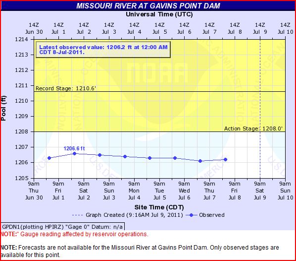
Missouri River Basin Flooding Summary
Overview

Releases across the Missouri River Basin continue to decrease at Nebraska City and Rulo, NE; however, widespread overtopping of levees continues. Four federal levees and 11 non-federal levees have breeched or overtopped across Iowa, Kansas, Nebraska and Missouri.
USACE Actions
  • Continues to provide technical assistance and levee repairs in support of local levee sponsors responsible for the Souris and Missouri River basins. A major flood fighting effort is ongoing to control and mitigate the impacts of flooding and levee overtopping throughout both river basins.
  • Continues to provide extensive amounts of flood fight supplies (sandbags, pumps, porta-dam) along with technical assistance to levee districts and communities in IA, KS, MO, and NE. As water levels have risen, USACE technical teams and levee sponsors are actively monitoring levees and addressing low spots, animal burrows, sandboils and seepage areas.
    • Continues to observe and monitor temporary flood protection projects along the entire Missouri River Basin.
Souris (Mouse) River Flooding – Minot, ND
Current Situation
As of 1:00 p.m. EDT on July 7, the river is at 1,556.6 feet. The flood stage is 1,549 feet. The outflow for Lake Darling measured along the Souris River at Foxholm was 9,120 cfs as of 1:30 a.m. EDT on Friday, July 8, 2011. USACE will continue to cut flows by 1,000 to 2,000 cfs daily or every other day, until the conservation pool is reached next week or unless conditions warrant different action. It is expected to take about two weeks for flood waters to recede to within channel banks. Reconstruction of the levees/recovery will begin in mid-July, when the flow will drop to 3,000-5,000 cfs.
Minot and Sawyer (Ward County), and Velva (McHenry County), ND

The mandatory evacuations remain in effect for portions of Ward County. Residents will be allowed to return home when the level at Minot reduces to 1,555 feet. The Broadway Bridge in Minot will be open daily from 8:00 a.m. – 9:00 p.m. EDT. Potable water remains a limiting factor in Minot (Ward County) with boil water orders in effect. Trinity Hospital has stretched the capacity of the National Guard supplied water purification unit. The loss of city water will likely result in the evacuation of health care facilities in Minot (Ward County). The State Water Commission has expressed concerned about bank erosion along the Missouri River as the water recedes. Mapping of the river in Bismarck/Mandan area will be used to identify potential danger areas. In North Dakota in support of the recovery of Minot, Burlington, Sawyer, and Velva, USACE has received the Mission Assignment for temporary housing site design and began the review of possible sites recommended by the City of Minot.

North Dakota

The Garrison Dam Reservoir is expected to remain nearly level for the next several days and then begin to recede. Releases have been reduced to 140,000 cfs. Mandatory evacuations remain in effect for Zones 1-9 (approximately 12,000 residents) Residents in the Evacuation Zones in NE Minot protected by the secondary dike will be allowed to return when the reading at the Broadway Bridge reaches 1555 feet. Voluntary evacuations remain in effect for portions of Morton (182) residents and Burleigh (694 residents). Three shelters are supporting 305 occupants in Ward and Mountrail counties.

Significant National Weather

South

Rain and thunderstorms are forecast for much of the Southeast and Lower Mississippi Valley today and into tonight. Some severe storms are possible in Virginia and the Carolinas, and may produce locally heavy rainfall. Triple digit temperature readings will continue across the Southern Plains and over the desert Southwest. Highs will average around 105 in Central Texas.
Midwest
Rain, thunderstorms, and strong winds are forecast for the Western and Northern Plains today and tonight. Locally heavy rainfall and severe storms are possible. Heavy rains are forecast for the Ohio Valley and Mid-Atlantic southward.
Northeast
Showers and thunderstorms are possible for much of the region today and tonight. A few severe storms are likely in the Mid-Atlantic this afternoon and evening. Some locally heavy rainfall is possible.
West
Showers and thunderstorms are expected from the Great Basin through the Rockies into the High Plains today through Saturday. Some severe storms are possible in eastern parts of Montana, as well as Wyoming, and Colorado. Flash flooding is possible in the Four Corners Region and parts of Nevada due to heavy rainfall. Strong wind conditions are possible in parts of the Northwest, including the Northern High Plains.

Tropical Weather Outlook

Atlantic / Caribbean / Gulf of Mexico
Area 1
Shower activity associated with an elongated area of low pressure extending from near the Yucatan Peninsula to the West Coast of Florida has decreased during the last several last hours. In addition, upper-level winds are expected to be only marginally conducive for further development. There is a medium chance (30%) of this system becoming a tropical or subtropical cyclone during the next 48 hours as it moves northward-northeastward. Regardless of development, this weather system could still produce periods of locally heavy rainfall across portions of the Florida Peninsula and the eastern Florida Panhandle during the next couple of days.
Area 2
Showers and thunderstorms associated with a tropical wave located a few hundred miles east-southeast of the southern Windward Islands have decreased. Significant development of this system is not expected. There is a low chance (0%) of this system becoming a tropical cyclone during the next 48 hours.

Eastern / Central Pacific
Tropical Storm Calvin
Tropical Depression Three-E has strengthened into the third tropical storm of the 2011 Eastern Pacific Hurricane Season. The tropical storm is located about 215 miles south-southwest of Manzanillo Mexico. Calvin is moving toward the west-northwest near 15 mph and this general motion (with some decrease in forward speed) is expected to continue during the next 48 hours. Maximum sustained winds are near 50 mph with higher gusts. Some strengthening is forecast during the next 48 hours. Tropical storm force winds extend outward up to 50 miles. There are no coastal watches or warnings in effect

Western / South Pacific:

No activity expected within the next 48 hours.

Earthquake Activity

No new activity (FEMA HQ)

Fire Activity

Thursday, July 7, 2011:
National Preparedness Level: 3
Initial attack activity: MODERATE (281 new fires)
New Large Fires: 4
Large Fires Contained: 2
Uncontained Large Fires: 20
Type 1 IMT Committed: 4
Type 2 IMT Committed: 5
States affected: NM, AZ, NC, GA, FL, LA, TX, OK, AR, CO, & NV

Wildfires


North Carolina

FINAL – Simmons Road Wildfire – FEMA-2936-FM-NC (approved July 4, 2011) – FINAL
The fire has consumed 5,632 (+232) acr
es and is 50 percent contained. Mandatory evacuation orders have been lifted. All shelters have been closed. The fire has destroyed 3 homes and 11 outbuildings. There have been no fatalities or injuries reported.

New Mexico

Las Conchas Fire – FEMA-2933-FM-NM (approved June 26, 2011)
The fire has consumed 136,995 (+6,365) acres and is 40% contained. The Bandelier National Monument, Kasha-Katuwe Tents Rocks National Monument, Santa Fe National Forest, and the Valles Caldera National Preserve remain closed. The Federal Aviation Administration has restricted air space in the Los Alamos area to allow for airborne firefighting operations. The USACE facilities at Cochiti Lake are closed through July11, 2011. The fire has destroyed 63 residences and 32 outbuildings. Approximately 565 residences, outbuildings and commercial buildings remain threatened. Five injuries and no fatalities have been reported.

Disaster Declaration Activity

Puerto Rico
On July 5, 2011, the Governor requested a Major Disaster Declaration Request for the Commonwealth of Puerto Rico as a result of heavy rains, flooding, mud and landslides during the period of May 20 to June 8, 2011. The Governor is specifically requesting Public Assistance for the twelve municipalities and hazard mitigation island-wide.

Mississippi

Amendment #5 was approved to Major Disaster Declaration, FEMA-1972-DR, for the State of Mississippi. The amendment is effective July 6, 2011 to request FEMA extend the cost-sharing arrangements set forth on May 5, 2011, regarding Federal funds provided under the authority of the Robert T. Stafford Disaster Relief and Emergency Assistance Act.

Last Modified: Friday, 08-Jul-2011 08:16:49 EDT

Friday July 8, 2011 - Missouri River 2011 Flooding Update


Heavy rainfall has kept the releases high not only at Fort Randall Dam in South Dakota - but at other 6 mainstem dams.


http://www.yankton.net/articles/2011/07/08/community/doc4e1679eadeea5569794883.txt


Sioux City Journal flood stories


Omaha's Epply Airfield Flood Fight


Video: Corps Using Phone Technology To Watch Levees


Col Ruch explains the benefits that the Mobile Information Collection Application (MICA) has given the Omaha District during the 2011 flood fight. Using Android phones and custom software engineers can send back near real time data back to decision makers.


RadiationNetwork.com


Updated in real time every minute. This is the first web site where the average citizen (or anyone in the world) can see what radiation levels are anywhere in the USA at any time


NOAA Hydrologic - Water Level at Gavins Point Dam, near Ft. Calhoun and Cooper Nuclear Plants


(The following link takes a bit to load all data)
http://water.weather.gov/ahps2/river.php?wfo=oax&wfoid=18705&riverid=203276&view=1%2C1%2C1%2C1%2C1%2C1%2C1%2C1&toggles=10%2C7%2C8%2C2%2C9%2C15%2C6&pt[]=141614&pt[]=144183&pt[]=142396&pt[]=143355&allpoints=143990%2C145585%2C145025%2C145026%2C144876%2C145027%2C143234%2C143184%2C145519%2C145640%2C144217%2C142150%2C142780%2C142853%2C145202%2C141586%2C144582%2C143543%2C144796%2C144098%2C144240%2C141320%2C141614%2C142968%2C144183%2C142574%2C143478%2C142193%2C142760%2C142003%2C142610%2C142396%2C144496%2C147345%2C141899%2C143355%2C142050%2C141570%2C144165%2C143476%2C141703%2C142023%2C144123%2C141863%2C143539%2C143436%2C141917%2C143009%2C142688%2C142640%2C143925%2C143734%2C142729%2C141978%2C143579%2C143348%2C142822&data[]=all&submit=Make+my+River+Page%21#bron1


BLAIR, NEBRASKA NEAR FT. CALHOUN NUCLEAR POWER PLANT


BROWNVILLE, NE - NEAR COOPER NUCLEAR PLANT


RESERVOIR CONTROL CENTER REPORTS

The following is the latest Reservoir Readings on the Upper Missouri River. This report is updated daily. Click on the picture for today's readings in reference to Gavins Point Dam, Ft. Randall Dam in SD, Big Bend Dam in SD, Oahe Dam in SD, Garrison Dam in ND and Fort Peck in Mt.

Link to daily report:
http://www.nwd-mr.usace.army.mil/rcc/reports/showrep.cgi?3MRDTAP7

July 8, 2011

June 13, 2011

The Cave's Archive: NW DIVISION OF THE US ARMY CORPS OF ENGINEERS RESERVOIR CONTROL CENTER DAILY REPORT


Link: THE CAVE'S OVERFLOW - Archive of the Cave's Daily Flood of 2011 Updates